
by Barbara Walvoord
I intend this column to be the first in a series on the waters of Lathrop–on both campuses, the brooks, wetlands, rainfall, storm water management systems, and–for today–the waters under our ground.
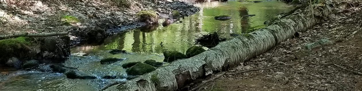
The closest I could get to photographing our underground water is this hole in the Easthampton woods where underground water emerges as a stream.
Our Easthampton campus sits on top of the Barnes aquifer, which provides most of the water for Easthampton and several neighboring towns, making us very vulnerable if this aquifer should dry up or get contaminated. Surface water–rain and run-off–replenish the aquifer.
Easthampton taps its aquifer by 5 wells. Two wells produce water pure enough to go directly into our homes. The others need costly treatment for pollutants. This is a familiar story, isn’t it? Some purity and some threat–same as for our woods and fields on both campuses.
Northampton campus sits not directly on an aquifer, but on one of the city’s most important areas for water protection–the Broad Brook/Fitzgerald Lake area. Our woodland’s leaves disperse hard rain; its roots soak up water; its soil and stones filter pollutants; and its brook channels the flow–all helping to control flooding and to filter pollutants.
Sources of pollution for underground water are storm water runoff, fertilizers and pesticides, chemicals, and manure. We can help protect our underground water by reducing our use of these substances and disposing of them in an environmentally responsible way.
Information above comes from Easthampton Open Space and Recreation Plan 2013-2020, draft, p. 17. (http://www.easthampton.org/downloads/Easthampton%20OSRP%20Plan&Appendices%20DRAFT_Sept2013.pdf), Northampton Open Space Plan (www.northamptonma.gov/DocumentCenter/View/923), the Barnes Aquifer Protection Advisory Committee (www.Bavac.pvd.org), and Cornell University (http://psep.cce.cornell.edu/facts-slides-self/facts/gr-wh-hw-grw85.aspx).
